
Public input sought on Darrell Road improvement concepts
Gregory Harutunian for Chronicle Media — February 15, 2017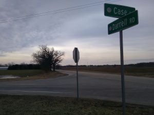
The intersection of Darrell and Case roads shows the skewed angle that turning traffic must negotiate, along with blurred lines of sight. (Photo by Gregory Harutunian/for Chronicle Media)
Planned improvements for the Darrell Road corridor, aimed at scaling back traffic congestion due to four of its feeder intersections, will be unveiled and tendered for public display at a Feb. 23 meeting in the Island Lake Village Hall. This is the third meeting for the project, and will be followed by a 28-day public comment period. It focuses on alternative measures to the present stop sign system.
The heavily used thoroughfare on the border of McHenry and Lake counties has seen an escalation in vehicle counts during peak rush hour periods resulting from commercial and residential development in the area. The Lake County Division of Transportation (LCDOT) is currently conducting an engineering study of the north-south route between Routes 120 and 176, and its intersections from Case Road to Fisher Road, through the Village of Island Lake and Wauconda Township.
The other two ingress and egress points are Neville and Dowell road, the latter with some line-of-sight problems contributing to delays. Project representatives will be on hand to discuss the project alternatives of a succession of roundabouts, or simply traffic signals. Evaluation criteria, preliminary cost estimates, along with feasibility and conceptual designs impacting the project are being presented.
“This is a series of four intersections in a row on Darrell Road, and the alternatives selected include the installation of roundabouts, and traditional traffic stop signals,” said Matt Emde, LCDOT’s project manager. “We’ll have detailed drawings and charts that flow with the geometrics of the main road, and the intersections that connect with it.
“Case, Neville, Dowell, and Fisher roads are the keys points. There was a third option, which was to do nothing, but that has fallen by the wayside,” he said. “These meetings for public input give us a chance to gauge what the response is, and what people in the area would like to see.”
The project will largely be funded from a federal grant through the Congestion Mitigation and Air Quality Improvement (CMAQ) Program, administered by the Federal Highway Administration of the U.S. Department of Transportation. Emde said the applications for the grants will be completed and forwarded to the agency, later this month.
“The geometrics and layout on the intersections have some problems, and stop signs are not really the most efficient means,” he said.
Each of the four stop-sign controlled intersections meet at skewed angles with Darrell Road, making turns a difficult maneuver and blurring sight lines. Traffic data collection has shown an increase in morning and evening rush hour congestion, stemming from drivers attempting to avoid the U.S. Route 12 corridor.
Commercial and residential development has also increased, specifically at the northern terminus situated in the Village of Lakemoor. Future retail construction, such as the planned Woodman’s Food Store at the corner of routes 12 and 120, will most likely affect travel patterns. Those considerations are being assimilated into the engineering proposals for improvements to the roadway.
An ancillary benefit of the improvements is the addition upgraded bicycle and pedestrian facilities within the study’s scope, and an eventual connection with the Grand Illinois Trail. The 535-mile loop is an Illinois Department of Natural Resources effort, and could intercept Darrell road at Case Road on a path leading to the Chicago area.
The meeting is being held from 5-7 p.m., in the Island Lake Village Hall, located at 3720 Greenleaf Avenue.