
City working on plan to improve Chicago River’s South Branch
By Igor Studenkov For Chronicle Media — June 4, 2025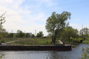
Canal Origins Park is one of several semi-connected parks that opened along the South Branch of the Chicago River in recent decades. (Photos by Igor Studenkov/For Chronicle Media)
Chicago’s Department of Planning and Development is eying improvements to the South Branch of the Chicago River as far west as Western Avenue — a roadmap that will build off several earlier plans completed by other city departments and Southwest Side community organizations.
The South Branch Framework Plan will tackle the long-discussed concept of turning the historically industry-heavy section of the river between Chinatown’s Ping Tom Park and Western Avenue into a more recreational destination South Siders can easily access. The past few years saw the release of several studies and plans that addressed the topic — most recently, the McKinley Park Development Council-led 2024 South Branch Connectivity Project Framework Plan. DPD is looking to “review, align and coordinate” those studies, putting together a single list of priorities and guidelines, and giving them legal force.
With much of the research and community outreach already done for previous plans, DPD expects to have the plan ready for Chicago City Council approval sometime in the fall.
While factories, warehouses and other industrial uses still dot the South Branch, many longtime industrial businesses have left. In the last 20 years, there has been growing interest in extending the Chicago riverwalk down the South Branch.
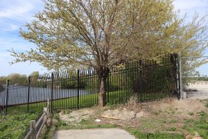
The riverwalk at Park No. 571 ends at the abandoned People’s Gas property.
As the South Branch Connectivity Project Framework Plan notes, several parks have been built, complete with riverwalks and amenities, such as piers and boat launches. However, there are several gaps. The Chicago River Design Guidelines approved in 2019 require any new development along the south riverbank to include a 30-foot setback to provide room for a riverwalk. Because zoning regulations aren’t retroactive, the city can’t compel any existing properties to add it unless the owners make substantial changes.
That plan also pointed out that parks aren’t always easy to reach. For example, Canalport Riverwalk park, which spans the section of the riverbank between Ashland avenues and the abandoned grain silos near Damen Avenue, is easy to access from the Ashland end. But, to reach the west end, residents currently need to take a stretch of 29th Street that has no sidewalks and is used by trucks serving the Anthony Marano Co. Grocery wholesaler complex.
The DPD presentation mentioned that, aside from Connectivity Project plan, it will be looking at the 2018 South Branch Park Advisory Council’s South Branch Parks plan, McKinley Park Development Council’s 2021 neighborhood plan, and Chicago Department of Transportation’s 2023 Chicago River Edge Access Study,
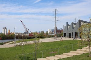
The boat launch at Park No. 751
City planner Rodrigo Martel Orihuela told the Plan Commission that the previous plans had certain common takeaways. They called for making the branch more walking and biking-friendly, creating more recreational opportunities, addressing pollution and planting native plants. This “invaluable work” that “highlighted the need” for DPD to develop something binding on the city level.
Martel Orihuela said that his department began working on the new plan in March. While there won’t be community outreach, they will be talking to organizations that developed the previous plans. The public will get a chance to review the plan before it goes to Plan Commission to a vote, then to the city council for final approval.
Ald. Daniel La Spata (1st Ward) one of the commission’s non-voting members, said that, while he appreciated the previous community outreach, he was worried that there were some parts of the community that didn’t get hurt — and he wanted to make sure the plan gets as much input as possible.
Ciere Boatright, the city’s planning and development commissioner, responded that her department is still open to input and feedback.
The study area falls within 11th and 12th wards, and Martel Orihuela said both Alds. Nicole Lee (11th Ward) and Julia Ramirez (12th Ward) “are supportive of this planning effort.” In a statement to Chronicle Media, Lee said she welcomed DPD’s work.
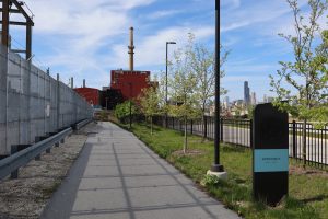
The South Halsted riverwalk starts on the edge of ComEd property — one of the gaps in the riverwalk network that would need to be addressed.
“We appreciate the thoughtful work of community organizations and groups like the National Park Service who have invested time and resources into imagining our river’s potential,” she said. “The City Planning Department’s effort to bring these visions together is an important step—not only to identify shared goals but also to assess what is truly feasible—as we work toward a river edge that is accessible and beneficial to all Chicago residents.”
Ramirez told Chronicle Media that she supported the earlier plans, and she was looking forward to what DPD comes up with.
“We’re really excited,” she said. “I think it’s the way to connect people, connects the communities, and [South branch] is a huge asset that we have.”
McKinley Park Development Council president Kate Eakin said that she was “very excited” to see two plans her organizations developed be incorporated into an official city plan.
“Together, these two plans represent the contributions of over 1,400 neighbors who came together to make their desires for our collective future known,” she said.
When the Connectivity Project Framework Plan was unveiled last summer, Eakin told Chronicle Media that she expected the city to take it into account. In a recent interview, she said that an official city plan would be an improvement.
“An official implementation plan for the South Branch will give these plans teeth and open up greater resources to improve riverfront access and amenities, as well as increase safe transportation options for pedestrians and cyclists,” Eakin said. “It’s a big win for residents.”
Trending News
 Hinsdale couple file $500 million ...A Hinsdale couple have filed a $500 million claim against a car ...
 Renovations close RiverEdge for seasonAurora’s RiverEdge Park is known around northern Illinois as a gem when ...
 Chicago police shoot two suspects ...Chicago police shot two suspects – one fatally – in separate incidents ...
 Suspect charged in fatal Streamwood ...A suspect has been charged in connection with the stabbing deaths of ...